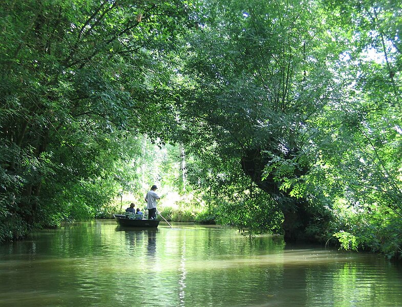
File:MaraisPoitevin.jpg
From Wikimedia Commons, the free media repository
Jump to navigation
Jump to search

Size of this preview: 785 × 600 pixels. Other resolutions: 314 × 240 pixels | 628 × 480 pixels | 1,005 × 768 pixels | 1,280 × 978 pixels | 1,620 × 1,238 pixels.
Original file (1,620 × 1,238 pixels, file size: 396 KB, MIME type: image/jpeg)
File information
Structured data
Captions
Captions
Add a one-line explanation of what this file represents
| DescriptionMaraisPoitevin.jpg | Marais Poitevin |
| Date | juiillet 2007 |
| Source | Own work |
| Author | Gilbert Bochenek |
| Permission (Reusing this file) |
This file is licensed under the Creative Commons Attribution 1.0 Generic license.
|
File history
Click on a date/time to view the file as it appeared at that time.
| Date/Time | Thumbnail | Dimensions | User | Comment | |
|---|---|---|---|---|---|
| current | 05:24, 27 August 2007 |  | 1,620 × 1,238 (396 KB) | Gilbertus (talk | contribs) | {{Information |Description=Marais Poitevin |Source=œuvre personnelle |Date=juiillet 2007 |Author=Gilbert Bochenek |Permission=CC-by |
You cannot overwrite this file.
File usage on Commons
The following 8 pages use this file:
File usage on other wikis
The following other wikis use this file:
- Usage on an.wikipedia.org
- Usage on az.wikipedia.org
- Usage on bar.wikipedia.org
- Usage on cy.wikipedia.org
- Usage on de.wikipedia.org
- Usage on de.wikivoyage.org
- Usage on el.wikipedia.org
- Usage on en.wikipedia.org
- Usage on eo.wikipedia.org
- Usage on es.wikipedia.org
- Usage on eu.wikipedia.org
- Usage on fi.wikipedia.org
- Usage on fr.wikipedia.org
- France
- Poitou-Charentes
- Réseau Natura 2000
- Poitou
- Tourisme en Charente-Maritime
- Marais
- Liste des marais français
- Marais poitevin
- Parc naturel régional du Marais poitevin
- Utilisateur:Gilbertus
- Label Grand Site de France
- Niort
- Climat de la Charente-Maritime
- Pôles-nature de Charente-Maritime
- Portail:Deux-Sèvres/Image-12
- Portail:Deux-Sèvres/Image-00
- Nouvelle-Aquitaine
- Réseau hydrographique des Deux-Sèvres
- Liste des sites classés et inscrits de la Vendée
- Paysage en France
- Réseau hydrographique de la Charente-Maritime
- Liste des sites classés et inscrits des Deux-Sèvres
- Usage on fr.wikibooks.org
- Usage on fr.wikivoyage.org
- Usage on ga.wikipedia.org
- Usage on hak.wikipedia.org
View more global usage of this file.
Metadata
This file contains additional information such as Exif metadata which may have been added by the digital camera, scanner, or software program used to create or digitize it. If the file has been modified from its original state, some details such as the timestamp may not fully reflect those of the original file. The timestamp is only as accurate as the clock in the camera, and it may be completely wrong.
| Camera manufacturer | Canon |
|---|---|
| Camera model | Canon PowerShot A95 |
| Exposure time | 1/60 sec (0.016666666666667) |
| F-number | f/3.5 |
| Date and time of data generation | 11:04, 11 July 2007 |
| Lens focal length | 13.59375 mm |
| Orientation | Normal |
| Horizontal resolution | 180 dpi |
| Vertical resolution | 180 dpi |
| Software used | Adobe Photoshop CS Macintosh |
| File change date and time | 01:17, 27 August 2007 |
| Y and C positioning | Centered |
| Exif version | 2.2 |
| Date and time of digitizing | 11:04, 11 July 2007 |
| Image compression mode | 3 |
| APEX shutter speed | 5.90625 |
| APEX aperture | 3.625 |
| APEX exposure bias | 0 |
| Maximum land aperture | 3.625 APEX (f/3.51) |
| Metering mode | Pattern |
| Flash | Flash did not fire, auto mode |
| Color space | sRGB |
| Focal plane X resolution | 9,159.0106007067 |
| Focal plane Y resolution | 9,169.8113207547 |
| Focal plane resolution unit | inches |
| Sensing method | One-chip color area sensor |
| Custom image processing | Normal process |
| Exposure mode | Auto exposure |
| White balance | Auto white balance |
| Digital zoom ratio | 1 |
| Scene capture type | Standard |
Hidden category: